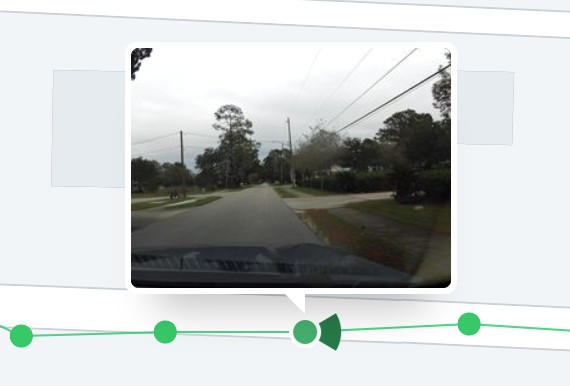
I would like to see Google Street View style imagery added to the map.
This imagery allows you to better plan a trip by showing details like storefronts, signage, sidewalks, entrances, and other street-level features. Often these features are difficult or impossible to discern from a top-down map or satellite view.
Examples of this feature are in Google Maps or Mapillary (commonly used in OpenStreetMap based apps.) Smaller datasets include KartaView and Mapilio.
The way this is presented visually in the map will likely depend on the dataset.
For example, Mapillary often lacks panoramas and imagery outside larger urban areas or main roads. Because of this, their data is usually displayed with a green line showing streets with imagery. Zooming in you can see dots where photos have been taken and hovering over a dot will show the photo angle.

On the other hand, Google offers much more imagery. So showing where you can street view would be a more cluttering experience (though situationally useful to toggle on/off?)